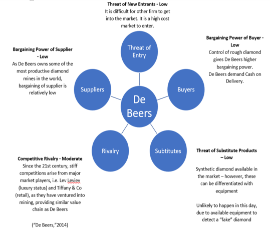
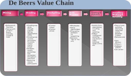
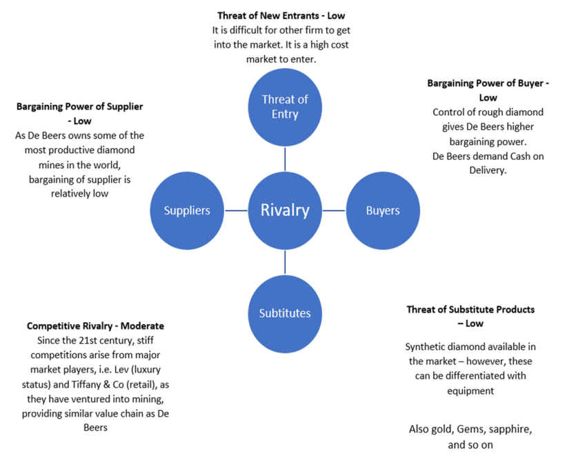
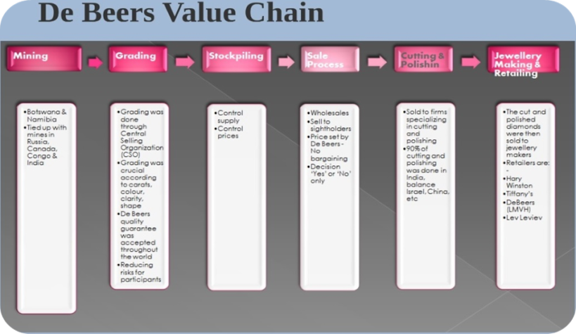
On my previous blog, I have discussed about our analysis on De beers in terms of Five Forces analysis, value chain, core competencies, and how information system has helped De beer’s business. However, my friend and I still realized that we still made some mistakes on our previous analysis. Therefore, we decided to revise it again and below is our analysis on De beers after we revised it and let’s get started with the first one which is from five forces analysis and De beers value chain.
And about De beer’s core competency, we have found that De beers is so expertise in the diamond industry which makes it as De beer’s core competency. In fact, De beers has an outstanding diamond expertise as they have a long history to develop unique and innovative of their jewelry design since the creation of De Beers Diamond Jewelers in 2001. Moreover, this group also has become the world’s leading diamond company, especially with unrivalled expertise in the exploration and mining of diamonds throughout the world. In addition, De beers is also often being said as the one that is able to develop a beautiful and iconic new jewelry design as it is commonly designed with a unique and so architecturally elegant design as De beers also has an advanced technology to produce diamonds with the same quality.
Moreover, we all know that De beers delivers more than a third of the world’s diamonds, and as the world’s largest diamond supplier, we all know that it is very necessary for them to have a supporting tool that can help them to keep their operation safe, secure, and well connected. In fact, we have found that De beers has used GIS for over twelve years in which it primarily functions in their exploration division and the first installation of GIS was actually in their exploration group where it now has more than 200 users with additional users in other divisions, including De Beers Marine and Mining, and Mineral Resources Management. Also, we found that GIS is actually directly linked to the Prospecting Information System as it will play an important role in the integration and one of the main goal or objective that we should know is that it is actually to make sure that all ventures in the De Beers Group Exploration have the same spatial database structure to facilitate information sharing and access to spatial data. In fact, the basis of the spatial database will actually utilize ESRI’s ArcSDE to manage spatial data distribution. Moreover, the enterprise application being designed for initial implementation is simply called as “the prospecting information management system” that will have responsible for providing prospecting information, and also generating a Personal Geodatabase for field usage and analysis.
Overall, that is all that I would like to share to you and I hope that this blog can be useful and give you some knowledge, also. Thank you very much and have a great day 🙂